The Perfect Solution to Measuring Distance
This is by far the perfect solution for penny pinching runners. Since Streetdirectory started charging for its route calculation services, I've been searching around for the best solution to calculate the distance of my romps around Singapore. I've finally found it. It is the free software MapEdit, coupled with a map of Singapore studiously put together by a few dedicated GPS enthusiasts in Singapore and Malaysia. What a great bunch of folks! I am very appreciative of their hard work.
Instructions:
1. Install MapEdit
2. Register as a member at malsingmaps.com
3. Download Singapore map
4. Open Singapore map with MapEdit
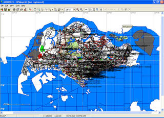
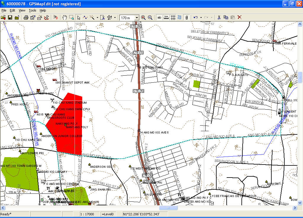
This is a screenshot of the Singapore map on MapEdit.
To calculate distance on MapEdit:
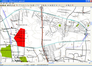
1. Zoom in to required area.
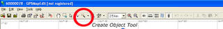
2. Select "Create object" on toolbar.
3. Mark points of route with mouse.
4. When done, right-click and select "End".
5. Specify type of object (as far as a runner is concerned, this changes only the colour and thickness of the line drawn in) and name the route.
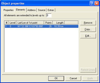
6. To see distance of route, select "Select Objects" on toolbar. (That's the little white arrow.)
7. Right-click on route and select "Properties". The distance is in the "Elements" tab.
To save map with running routes:
1. Save map in "Polish format".
2. Export map to "Garmin IMG/ cgpsmapper.exe".
3. Save map.
As a bonus, malsingmaps.com also has downloadable maps of the roads and trails in Malaysia. Best of all, this solution is completely free. It does not require an internet solution, and is quick and easy to use. :) Great stuff eh?
Instructions:
1. Install MapEdit
2. Register as a member at malsingmaps.com
3. Download Singapore map
4. Open Singapore map with MapEdit
This is a screenshot of the Singapore map on MapEdit.

To calculate distance on MapEdit:
1. Zoom in to required area.
2. Select "Create object" on toolbar.

3. Mark points of route with mouse.
4. When done, right-click and select "End".
5. Specify type of object (as far as a runner is concerned, this changes only the colour and thickness of the line drawn in) and name the route.
6. To see distance of route, select "Select Objects" on toolbar. (That's the little white arrow.)
7. Right-click on route and select "Properties". The distance is in the "Elements" tab.

To save map with running routes:
1. Save map in "Polish format".
2. Export map to "Garmin IMG/ cgpsmapper.exe".
3. Save map.
As a bonus, malsingmaps.com also has downloadable maps of the roads and trails in Malaysia. Best of all, this solution is completely free. It does not require an internet solution, and is quick and easy to use. :) Great stuff eh?
Posted
on Monday, October 24, 2005 at 9:25 AM.
:)
![]()
Great tip! But u linked the wrong MapEdit.. it shd be GPSMapEdit at http://www.geopainting.com/en/
Keep running! :)
6:33 PM
If you are using a Garmin GPSr and have access to Garmin Mapsource, calculating your planned running distance is even easier. Just use the "routing" feature of Mapsource by defining your starting point and your ending point (add intermediate point as necessary). Mapsource will give you distance and estimated time too (you can set your running speed). ;-)
BTW, I just found your blog post by this new Google's Firefox Blogger Web Comments plugin from Google.
5:53 PM
Thanks, oh for the correction!
4:29 PM
» Post a Comment