A run, distilled

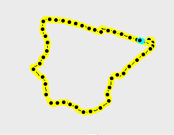
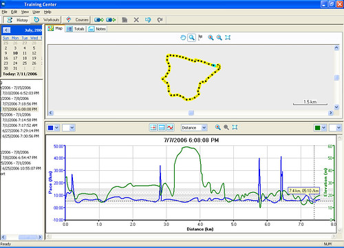
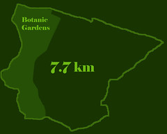
The map on top is drawn from an electronic map, while the breadcrumb trail below is generated by the Garmin Forerunner. Using MapEdit, I get a total distance of 7.7km. With the Garmin Forerunner, I get 7.35km. I'm not sure why the graph registers 7.6km instead (see graph below). I assumed it was the "resting distance", but I've noticed a discrepancy even in cases without it.
The Garmin also gives me my pace and the elevation of the route. Check out the pace on the upslope!

The four spikes are where I stopped at traffic lights. The Garmin Forerunner was set to autopause at a walking pace (you can configure your walking pace under profile), and autolap at 1km. There is a distance alarm at 5km.
The Garmin works great as long as you can get a signal. If you run under the trees and lose signal, the Forerunner recalculates your distance and average pace when you get back under a clear sky with the assumption that you ran in a straight line.
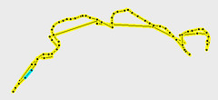
For example, you can see the stright lines where I lost reception in the breadcrumb of the 5km boardwalk route at MacRitchie (see route below). For some reason I lost reception on the way there but not on the way back.

Garmin registered 4.49km for that run (4.9km on graph). What's up? The resting distance on that run was 0km too. Hmmm.
The Garmin connects with the computer via the serial port. Although that is a old-fashioned way of connecting, if you're running out of free USB ports like me, it may be a good thing.
Obviously I haven't figured out the Forerunner yet and there are still some things I'm confused about. But I still think it is spiffy that I can wear something on my arm that speaks to satellites in the sky.

» Post a Comment